Fort McMurray, Alberta
Wikimedia Commons via Wikipedia

Alberta · Civic arena

Fort McMurray

Fort McMurray drinking water hardness is 162 mg/L on OpenStats, plus City Score rankings and local readings.

Civic arena · hometown HUD

Fort McMurray

City68k pop
56XP
#94

#94 of 343

56% City Score XP

RisingDirectSoftestSurface
City Score XP

7/8 pillars on the board

56%#94

Decade trail

Fort McMurray packs 7 of eight open-data pillars into its composite standing. Tap a rival below to see how the hometown stacks up head-to-head.

Fort McMurray drinking water

Direct municipal reading

Hardness, pH, and lead from municipal reports on the OpenStats water atlas.

Hardness
162 mg/L
hard
pH
7
Lead
0.2 μg/L

Full Fort McMurray water quality report →City Score rankingsCompare cities · vs Medicine Hat · vs Drayton ValleyHardness guide

Watershed to tap · system map

How Fort McMurray's water works

Open full map

Source, treatment, and distribution for Fort McMurray from municipal and provincial water records. Hardness and grade are published readings.

Local numbers for Fort McMurray

Drinking water first, then permits, tax, internet, radon, and hazards for Fort McMurray.

How Fort McMurray scores

Rising+100

Fort McMurray sits at City Score rank #94 with a standing of 56%, from 7 of 8 open-data pillars (tax, construction, connectivity, indoor air, water, seismic hazard, growth, safety). Missing pillars score at median standing so thin coverage cannot inflate the rank. Rising 100 places versus 2022 (#194 → #94).

Latest owned placements: building permit value rank #247 of 343 (2025); indoor radon rank #160 of 343 at 162 Bq/m³ survey mean; residential mill rate rank #301 of 343 (7.67 mill rate). Full tables and method notes live on each study edition; atlas readings for the same slug open from the topic buttons.

#94
Arena rank (of 343)
56%
City Score
7
Pillars observed
Rising+100
vs 2022
#194 → #94

Arena loadout

Topic XP bars

Arena rank #94 of 343

City Score

7/8 pillars · main XP bar

56%#94
Drinking water

Rank #200

58%
Building permits

Rank #247

28%
Internet

Rank #28

92%
Radon

Rank #160

47%
Hazards

No placement

Property tax

Rank #301

88%

Achievements

Rising +100Direct municipal readingSoftest waterSurface water supply

Hometown notes

Archive

Earlier years: 2026 · 2025 · 2024 · 2023

Fort McMurray in brief

Fort McMurray sits where the Athabasca River meets the Clearwater River, the urban hub of Wood Buffalo in northern Alberta. People here lean on RMWB shorthand the way other towns lean on a city hall nickname, and construction notices still split projects North of Bridge or South of Bridge. Oilsands work sets the economic weather for households and downtown storefronts alike. River Breakup season sets another kind of calendar, when municipal updates shift from winter operations to ice-out and flood watch.

Downtown Fort McMurray keeps drawing civic attention through revitalization incentives aimed at commercial and mixed-use upgrades, while the Lower Townsite stays tied to Keyano College and the recreation work nearby. Franklin Avenue carries the civic address strip. The Snye Waterway gets its annual weed harvest. Abasand shows up on the parks map with an outdoor rink, perimeter trail, and OHV staging. Rural communities such as Janvier sit on the same Wood Buffalo map even when the daily desk is covering the urban core.

Recreation runs deep for a northern industrial town. Birchwood Trails stretch across a long maintained network, and MacDonald Island Park anchors culture programming, including the Kirschner Family Community Art Gallery. WinterPLAY and Canada Day are the civic party nights people plan around. Jubilee Gallery keeps public art in the Jubilee Building lobby. Fort McMurray Today's mix of energy, utilities, sports, and street-level crime coverage is the soundtrack: a river confluence town that also happens to be the oilsands capital of the region.
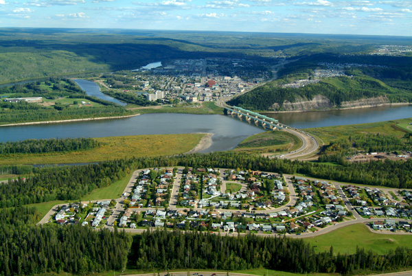
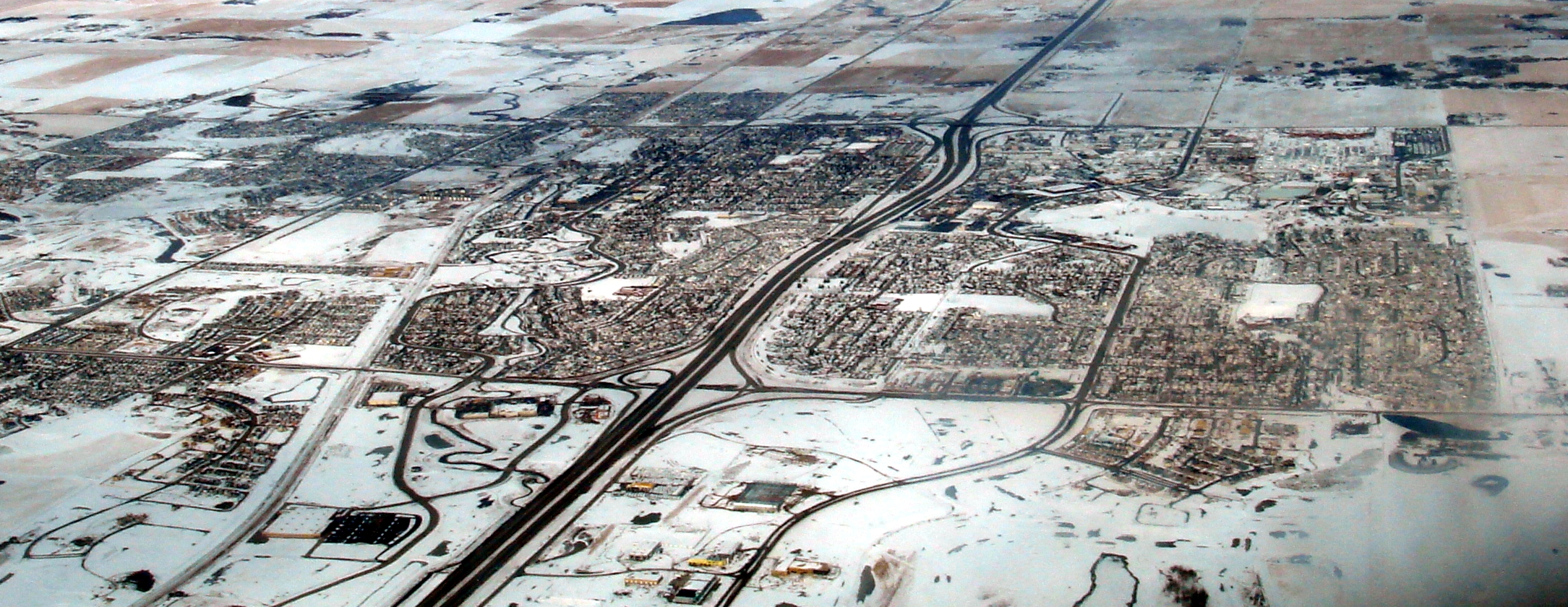
Drawn from Regional Municipality of Wood Buffalo, Fort McMurray Today, Regional Municipality of Wood Buffalo, Regional Municipality of Wood Buffalo.

City Score over time

City Score from 2016–2025 across eight open-data pillars. Individual study placements are listed in the panels below.

0%25%50%75%100%2016201720182019202020212022202320242025
OpenStats City Score

Rankings for Fort McMurray

Each study below is its own ranking. Where a study has more than one edition for this city, the chart shows standing across those years only.

Connectivity · OpenStats

OpenStats Broadband Download Speeds

OpenStats

Cities ranked by estimated best advertised download (Mbps). Anchored to the current ISED National Broadband Data vintage, then backcast along a national speed curve with city-specific fiber-arrival and 50/10 availability paths so relative ranks can change over the decade. Not a claim of audited historical hex maps for every year.

10 editions · 2016–2025

#28
Latest · 2025 · of 343
Score 686.1

Construction · OpenStats

OpenStats Building Permit Value

OpenStats

Cities ranked by calendar-year building permit value. Direct rows sum Statistics Canada Table 34-10-0292-01. Cities without a direct reading use population × provincial per-capita permit intensity (estimated), so every seed city has a year-varying construction signal.

10 editions · 2016–2025

#247
Latest · 2025 · of 343
Score 301521497

Composite · OpenStats

OpenStats City Score

OpenStats

Dimensional average of OpenStats open-data pillars for each panel year 2016–2025: tax, construction, connectivity, indoor air, water, seismic hazard, population growth, and crime severity. Each series is scored 0–1 within its edition; series in the same pillar are averaged, then all eight pillars are averaged with equal weight. Missing pillars score at median standing (0.5). Growth and CSI use StatCan annual tables; permits, mill rates, and broadband use live rows plus documented year-varying estimates where needed. Radon, water, and PGA may be survey/model vintages carried forward and are flagged when static for more than two years. External commercial livability lists are never inputs.

10 editions · 2016–2025

#94
Latest · 2025 · of 343
Score 0.557

Safety · OpenStats

OpenStats Crime Severity Index

OpenStats

Communities ranked by Statistics Canada Crime Severity Index (Table 35-10-0026-01). Rank 1 is highest CSI (worse). Values are CMA where a metro match exists, otherwise provincial CSI. Hometown pages label the grain.

10 editions · 2016–2025

#110
Latest · 2025 · of 343
Score 90.62

Water · OpenStats

OpenStats Drinking Water Hardness

OpenStats

Communities ranked by municipal drinking-water hardness (mg/L as CaCO₃). Hardness changes slowly; the atlas vintage is carried across panel years and flagged when static for more than two years.

10 editions · 2016–2025

#200
Latest · 2025 · of 343
Score 162

Health · OpenStats

OpenStats Highest Indoor Radon

OpenStats

Communities ranked by Health Canada survey mean indoor radon (Bq/m³). Rank 1 is the highest mean. Decade panel years without a new survey carry the CMA survey vintage forward; they are not annual retests.

10 editions · 2016–2025

#160
Latest · 2025 · of 343
Score 162

Growth · OpenStats

OpenStats Population Growth

OpenStats

Cities ranked by year-over-year population growth from Statistics Canada annual CSD estimates (Table 17-10-0155-01). Rank 1 is fastest growth. A few places without a clean CSD match use a provincial-path estimate anchored to seed population.

10 editions · 2016–2025

#181
Latest · 2025 · of 343
Score 0.010287199801931171

Property tax · OpenStats

OpenStats Residential Mill Rates

OpenStats

Municipalities ranked by residential mill rate. Rank 1 is the highest rate. Published municipal years are used when available; gaps are interpolated or follow the provincial median path so the tax pillar moves year to year for every city.

10 editions · 2016–2025

#301
Latest · 2025 · of 343
Score 7.672956152444171

Livability

Globe and Mail Most Livable Cities

The Globe and Mail

2023 data partnership with Environics Analytics ranking 439 Canadian communities on ten livability categories.

Single edition · 2023

#51
Published · 2023 · of 439

Only one published edition places Fort McMurray in this study so far. Open the edition for method notes and the full table.

Original source · Full edition

Worth knowing in Fort McMurray

Distinctive local notes and places, each linked to its source.

Places to see

Birchwood Trails

A sprawling maintained trail network woven through the urban Wood Buffalo landscape. Locals treat it as everyday recreation infrastructure, not a tourist sidebar.

MacDonald Island Park

The recreation and culture campus where programming and public art share the same address. The Kirschner Family Community Art Gallery gives the island a gallery stop beyond the rinks and fields.

Downtown Fort McMurray

The commercial core targeted by downtown revitalization incentives for upgrades and mixed-use work. Franklin Avenue keeps the civic offices in the same conversation as the storefronts.

Snye Waterway

A working waterway on the municipal maintenance calendar, including the annual weed harvest. It is part of how the town keeps its river system usable, not just photogenic.

Follow Fort McMurray by email

When Fort McMurray moves in a ranking, posts new permit figures, or lands in a study, get a short note. A few sends a year, only when something changes.

No spam. Unsubscribe with one reply.

Related guides

More places in Alberta

All Alberta cities